

SC I-95 Improvements from Ridgeland (Exit 22) to US 17 (Exit 33)
Public Information Meeting

How to Participate
Building on the improvements that will be under construction later this year on I-95 from the Georgia border to Exit 8, SCDOT is evaluating ways to Fix Your Drive on I-95 between Miles 8 and 21 while planning for future growth in this corridor.
The official public comment period closed on February 14, 2025

Open House Public Meeting
An open house occurred from 5:00 to 7:00 pm on Thursday, January 30, 2025
Hardeeville Recreation Center
285 John Smith Road
Hardeeville, SC 29927
traductores de español disponibles

View Materials Online
Review the meeting materials below
Do You Use The Juanita M. White Pedestrian Bridge?
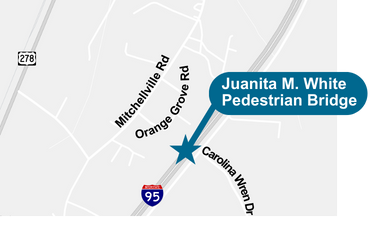
A Drop-In Neighborhood Meeting was held on Thursday, February 6, 2025 from 4:00 - 6:00 pm
Ridgeland Senior Center
444 Wise St
Ridgeland, SC 29936
Neighbors who use the Juanita M. White Pedestrian Bridge were invited to this community drop-in to learn more and help us understand how they use the bridge.
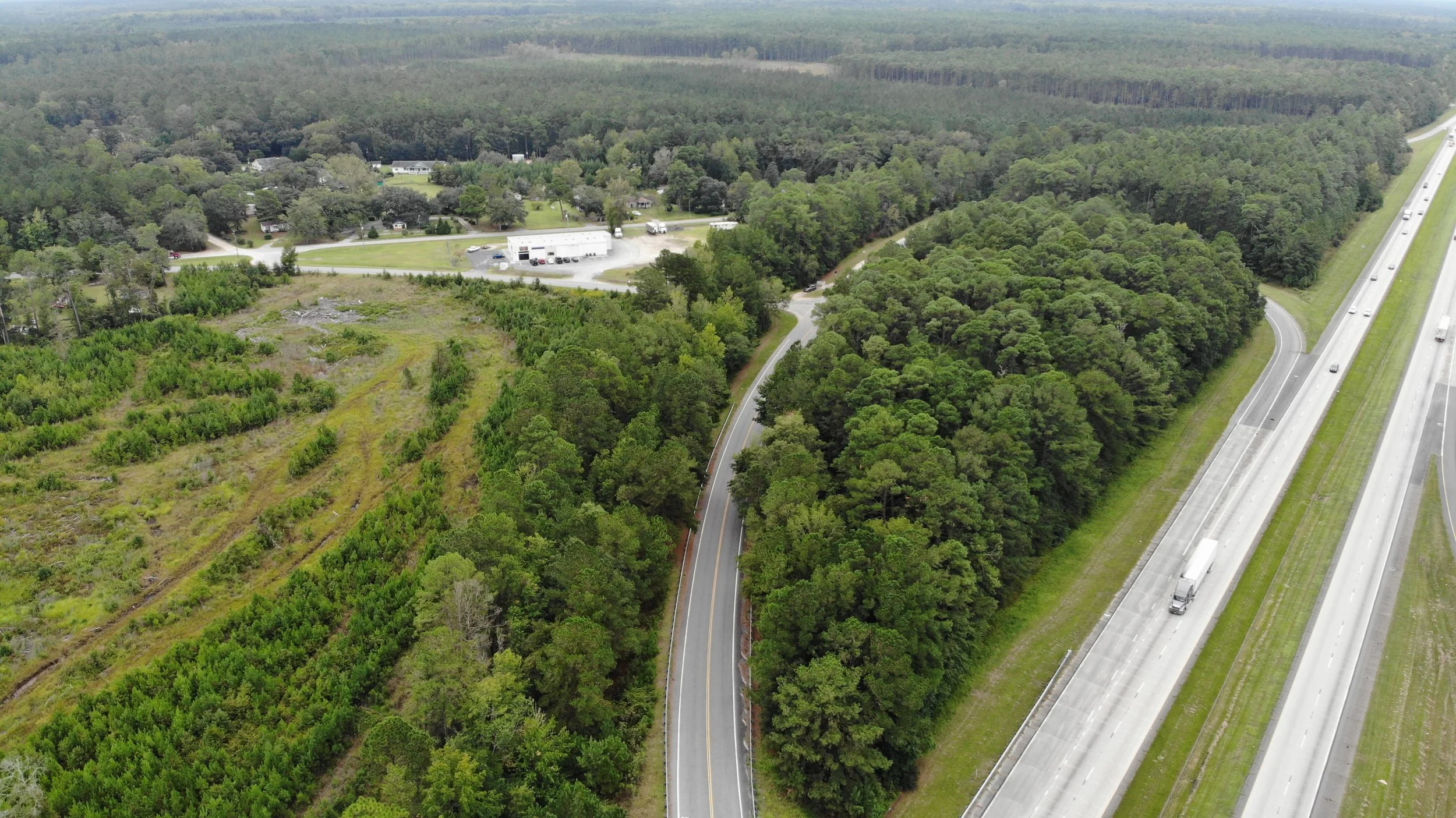
SCDOT is proposing improvements on I-95 between US 278 (Exit 8) to SC 336 (Exit 21). SCDOT and the Federal Highway Administration are developing an environmental assessment document for the proposed improvements.
The purpose of this proposed transportation project is to improve capacity, mobility, and operations along the 13-mile corridor of I-95, between Mile Markers 08 and 21, and to address operational deficiencies for interchanges and bridges within the study corridor. This means providing more space that’s better configured to move people and goods throughout the corridor.
Why is this project needed? The region is growing and is anticipated to continue growing, with more residents and economic opportunities. This means more traffic, and we need to accommodate for future growth.
Transportation improvements are needed to address operational capacity and traffic operational issues on the mainline as well as traffic operational deficiencies on interchanges and bridges along the corridor. The need for the project stems from projected increases in congestion.
Click the images for a larger view of the information. These images are duplicates of the boards and materials that were presented at the in-person Public Information Meeting on January 30, 2025.
About the Project
I-95 Fix the Drive
Program Overview
Study Area
Draft Purpose & Need
Project Development Process
Traffic Growth
With the continued growth in residents and jobs surrounding the region, it is also anticipated that there will be more demand to use this portion of I-95 (read: more cars and trucks on the road). The images below illustrate the current traffic conditions (2024) along I-95 during morning and evening rush hours as compared to what is anticipated in 2052 if improvements are not made. These times represent when the roadway is most used (peak hours). Additional detail is provided for the two exits within the study area, Exits 18 and 21.
Improvements are being explored at Exit 18 because of several elements that do not currently meet the design standards. At the same time, improvements are being explored at Exit 21 because of anticipated traffic performance challenges where the I-95 ramps meet with local roads.
Click the images for a larger view of the information.
I-95 Mainline Performance
Exit 21: Intersection Performance
Exit 18: Operational Deficiencies
Potential Improvements
As part of the environmental assessment, a range of potential improvements, known as alternatives, has been developed to address capacity, mobility, and operational deficiencies along I-95 as well as at Exits 18 and 21. In addition to those shown below, the range of alternatives also includes the “No Build” option in which no improvements are made. Each of the alternatives below shows a widening from 2 to 3 lanes in each direction.
At this time, no single alternative has been chosen. Instead, this is the first step in the process, and we are looking for your input. After exploring the potential improvements in this section, read more in the next section on how the alternatives will be evaluated and refined to identify the Recommended Preferred Alternative.
Click the buttons below to view PDFs of the potential improvements. PDFs will open in a new window.
Corridor Map
Potential improvements along I-95
Exit 18
Alternative 1: Double Roundabout at Exit 18
Alternative 2: Partial Cloverleaf A at Exit 18
Alternative 3: Partial Cloverleaf B at Exit 18
Exit 21
Alternative 1: Diamond Interchange at Exit 21
Alternative 2: Double Roundabout at Exit 21
Curious why roundabouts are being explored? Learn more.
¿Tienes curiosidad por saber por qué se están explorando las rotondas? Aprende más.
Evaluating the Proposed Improvements
Selecting the improvements that best balance the project requires a thorough evaluation process. Each of the alternatives identified above will be evaluated against the same set of criteria through a multi-step process. With each step, the analysis will become more detailed and the lowest-performing alternatives will be eliminated. Public and stakeholder input is essential in narrowing the options. Ultimately, this process will help SCDOT arrive at what is known as the “Recommended Preferred Alternative.” The Recommended Preferred Alternative will be brought back to you for your feedback at the public hearing which is currently anticipated to happen in the fall of 2025.
Click the image for a larger view of the information.
Evaluating Alternatives
Environmental Constraints
Infrastructure improvements must carefully consider environmental factors to minimize impacts. The map linked below details the environmental constraints within the project area, including wetlands, wildlife habitats, and cultural resources. These environmental factors will be considered and quantified in the second step of the alternatives evaluation process.
Click the buttons below to view PDFs of the potential improvements. PDFs will open in a new window.
Evaluating Traffic Noise
Highway improvements can affect nearby noise levels, requiring detailed analysis to identify potential impacts. This board outlines SCDOT's process for evaluating noise, including monitoring existing levels, modeling future scenarios, and considering mitigation measures like noise walls to minimize disruptions for nearby residents.
Click the image for a larger view of the information.
Noise Evaluation Process

To understand the noise evaluation process in greater detail, view our traffic noise handout.
Click the buttons below to view PDFs of the potential improvements. PDFs will open in a new window.
Right-of-Way Acquisition
Right-of-way acquisition is a key step in delivering transportation improvements. This board explains SCDOT's right-of-way process, which ensures transparency, compliance with federal guidelines, and support for affected property owners and residents through design, appraisal, and relocation.
Click the image for a larger view of the information.
Typical Right-of-Way Process
How to Comment
We value your input. Please make sure to share your input using our comment form below. The official public comment period closed on February 14, 2025.
NOTE: Information provided, including name, address, and email, will be published and is subject to disclosure under the Freedom of Information Act.